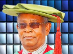
A Professor of Geoinformatics and Surveying at the University of Nigeria, Nsukka (UNN), Victor Nnam, has called for the integration of artificial intelligence, indigenous knowledge, satellite technology and human expertise to improve spatial analysis and accelerate the achievement of the Sustainable Development Goals (SDGs) in Nigeria.
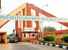
Nnam made the call on Thursday while delivering a keynote address at the Annual International Conference of the College of Postgraduate Studies, Enugu State University of Science and Technology (ESUT).
Speaking on the theme, “Geospatial Innovation for Sustainable Development: The Art of Spatial Analysis for Integrating Artificial Intelligence, Indigenous Knowledge, and Remote Sensing toward Achieving the Sustainable Development Goals,” the former Enugu State Commissioner for Lands and Urban Development said sustainable development interventions must be informed by reliable location-specific data and community knowledge.
He noted that the 17 SDGs were fundamentally location-based, explaining that challenges such as poverty, hunger and gully erosion were tied to specific geographical locations and required targeted solutions.
According to him, despite advances in satellite technology and other geospatial tools, global assessments of progress towards the SDGs still suffer from inadequate spatial information.
“Of 29 geospatial SDG indicators, eight are reported by fewer than 25 per cent of UN member states, while Indicator 5.2.2 is not reported by any,” he said.
Nnam argued that Nigeria’s major challenge was not the absence of satellite technology but the need to strengthen institutions and knowledge systems capable of integrating satellite evidence, indigenous knowledge, community experiences and professional expertise.
He said such integration would ensure that decisions based on geospatial information were credible, accountable and useful to courts, local councils and communities.
The professor proposed a Human-Centred Geospatial Framework built on four pillars: human intelligence, indigenous knowledge, innovation and artificial intelligence.
He stressed that the four components must operate together, noting that meaningful geospatial intelligence could only emerge when technological capabilities were combined with human experience and local knowledge.
“Spatial analysis is the interpretive discipline that separates a map from a meaningful decision,” Nnam said, emphasising that geospatial professionals must go beyond producing maps to interpreting data in ways that support sound public policy and development planning.
To demonstrate the importance of spatial analysis, he presented research findings on gully erosion in Anambra State, showing how a global statistical assessment could suggest the absence of a significant spatial pattern even when local analysis revealed two areas with high concentrations of erosion.
He further explained that the results of spatial analysis could change considerably depending on how geographical data were grouped into administrative units.
In another example involving Enugu State, Nnam said a regression analysis of population density across the state’s 17 local government areas produced an R-squared value of 0.884.
However, he cautioned that such a strong overall statistical relationship did not necessarily explain where the relationship held geographically unless the model accounted for spatial variation.
The don also highlighted the risks of relying exclusively on satellite imagery for land titling, presenting a structured simulation suggesting that such an approach could overlook 75 out of every 80 parcels with undocumented customary claims.
He said the example underscored the importance of incorporating indigenous land knowledge and community participation into land administration processes.
Nnam presented five case applications drawn from his previous publications and research, as well as the work of other scholars.
The cases covered fit-for-purpose land administration, erosion monitoring, food-security advisory services, participatory conflict mapping and deep-learning-based shoreline assessment in the Niger Delta.
He also outlined an implementation pathway for Enugu State and challenged the College of Postgraduate Studies to train professionals capable of interpreting geospatial evidence responsibly.
“We are not here to train technicians who simply make maps, but rather we are here to train professionals who must determine, with evidence and accountability, what those maps are allowed to mean and how they should guide decisions,” he said.
He maintained that the effective use of geospatial technology would depend on the ability of professionals and institutions to combine scientific evidence with local realities in addressing development challenges.